
How to Read the Avalanche Forecast

How to Read the Avalanche Forecast
The forecast gives you the avalanche danger level, key risks, expert observations, and weather insights.
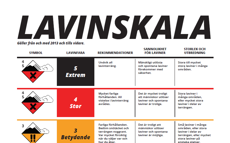
Avalanche Danger Scale
The avalanche danger scale is the primary tool used to assess and communicate avalanche hazard. It describes the overall avalanche…
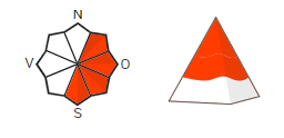
The graphic for the most vulnerable places
The most vulnerable heights and direktions are shown in red.
Avalanche Problems
The six avalanche problems provide clues for identifying the most dangerous areas and typical methods for reducing the risks.
Slope Map
On the map, you can see where it is steep enough for avalanches to be triggered.
Slope Directions
With this tool, you can explore the slope directions in the area you're interested in.
Reported avalanches
The map tool "Reported Avalanches" shows avalanches we are aware of that have occurred within the past 72 hours.
How to Use the Avalanche Terrain Map Layer
The Avalanche Terrain map layer shows where terrain is steep enough for avalanches to start and how far they may travel once released.…